From Seville: Pueblos Blancos, Ronda & Olive Oil Tour
10 hours
A Sierra de Grazalema loop from Seville through Zahara and Grazalema, with an olive oil mill visit and an afternoon in Ronda, but no Setenil stop.
from$89
Check availability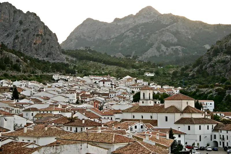
Grazalema is a mountain village of about 2,000 people inside the Sierra de Grazalema Natural Park, 31 km from Setenil. It averages about 2,000 mm of rain a year, among the highest totals in Spain. It is the area's hiking base, and four of the best park trails, including the Pinsapar and Garganta Verde, need a Junta de Andalucía permit.
Grazalema is the mountain village of the white villages route. It sits at over 800 m in the middle of the Sierra de Grazalema, under grey limestone peaks, with 1,977 residents (INE, 2025). People come for the hiking and, more than anything, the rain.
From Setenil de las Bodegas it is 31 km, about 50 minutes by car. Ronda is about 32 km away on the A-372.
It is one of the wettest. The Asociación Meteorológica Española (AME), Spain’s meteorological association, put Grazalema’s average at about 2,000 mm of rain a year in an April 2026 article, and said its weather station is, by a wide margin, the Spanish station that most often records more than 1,000 mm in a single month. Spain’s environment ministry describes the Sierra de Grazalema as the point of highest rainfall in Andalusia and one of the highest in Spain. Cádiz’s tourism board goes further and claims the highest rainfall index in the Peninsula.
The reason is the shape of the land. An AEMET paper from 2024 describes Grazalema as a rainfall singularity for the whole country. The Sierra del Pinar, just above the village, is the first mountain wall that wet westerly winds meet about 80 km from the coast. Air is forced upwards, cools and drops its rain.
For comparison, the hills around Setenil and Ronda get roughly 770 mm a year, by our reading of 1991 to 2020 climate model data. Grazalema gets more than twice that.
The last winter broke the records. According to the same AME article, Grazalema’s station measured 4,491.6 mm between 1 October 2025 and 28 February 2026, beating the calendar-year record of 4,385 mm set in 1963. On 4 February 2026 it recorded 577.0 mm in 24 hours, the highest daily total since records began there in 1912.
Water rose from the ground into houses in the lower part of the village. On 5 February the authorities evacuated the whole village as a precaution, and most residents were taken to Ronda. Vozpópuli reported that people began returning in stages from 16 February, with schools reopened and a monitored exclusion zone around the worst-hit streets.
What this means for a visit in late 2026. Most residents were back home by late February. The CA-9104 road over the Puerto de las Palomas to Zahara was damaged and reopened on 29 June 2026 after emergency works. On the Garganta Verde trail, the Bocaleones exit of the full canyon route was still closed for storm repairs in October 2026. Before you go, check road conditions and the Junta’s trail page, especially after heavy rain.
Grazalema has belonged to Los Pueblos Más Bonitos de España since 2017, two years before Setenil joined. Its old town is a declared Conjunto Histórico, a protected historic centre. Cádiz’s tourism board calls the baroque church of Nuestra Señora de la Aurora the village’s finest building; the Encarnación church, the church of San José and the hermitages of El Calvario and Los Ángeles are the others to look for.
The village is known for its blankets, the mantas de Grazalema. They are shown with other local crafts at the Museo de Artesanía Textil, the textile museum.
Benamahoma, a hamlet that belongs to Grazalema on the road west towards El Bosque, holds a Moros y Cristianos festival. In Grazalema itself, local festival listings give the Lunes del Toro, a rope-led bull run through the old town, on the Monday after 16 July.
The park is the reason most hikers come. It became a UNESCO Biosphere Reserve in January 1977, Spain’s first together with Ordesa-Viñamala. The reserve covers 53,411 hectares across 15 municipalities in Cádiz and Málaga, including Grazalema, Zahara de la Sierra, Ubrique, Algodonales, El Bosque, Benaoján (for the Cueva del Gato) and Ronda. Setenil and Olvera are outside it.
Spain’s environment ministry lists more than 1,400 plant taxa and more than 200 vertebrate species, with griffon vultures, golden eagles, Bonelli’s eagles, Egyptian vultures and Spanish ibex among them. Its signature is the pinsapo, the Spanish fir. The ministry calls the pinsapo forest the true symbol of the reserve.
The best-known summit is El Torreón, at about 1,650 m, the highest point in Cádiz province.
Four of the park’s best-known trails need an authorisation from the Junta de Andalucía. The figures below are from the Junta’s own trail sheets and Ventana del Visitante pages.
| Trail | Length (one way) | Time | Difficulty | Season rule |
|---|---|---|---|---|
| El Pinsapar | 10.5 km | 4 h 30 | Medium | Permit needed |
| El Torreón | 3.0 km | 2 h | High | Closed 1 June to 15 October (fire risk) |
| Llanos del Rabel | 6.2 km | 2 h | Low | Ends at the Llanos from 1 June to 15 October |
| La Garganta Verde | 2.4 km | 1 h 30 | High | Walk to the Ermita cave only 16 October to 31 May |
How to apply. Individuals apply through the El Bosque visitor centre, on Calle Federico García Lorca in El Bosque, or through the booking link on the Junta’s Ventana del Visitante page for each trail. Clubs and tour companies go through the park office instead. The contact email and phone differ between the Junta’s trail sheets and its website, so use the Ventana del Visitante page as the current reference.
Plan ahead for spring weekends and autumn. Because of the summer fire rules, the restricted trails are mostly a mid-October to May activity. Dogs are not allowed on the Garganta Verde, which lies in the reserve area.
El Pinsapar starts a couple of kilometres from Grazalema, near the old quarries on the road up to the Puerto de las Palomas, and runs to Benamahoma. It is the walk to do if you want to see the fir forest. El Torreón is a steep climb of 779 m over 3 km to the top of the province.
GetYourGuide has no guided hike inside the park that we could find, so for a guide, look for local active-tourism companies, which arrange their permits through the park office.
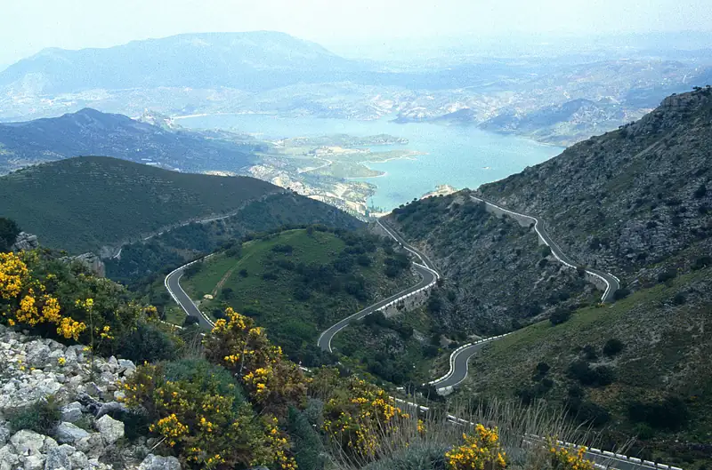
By car, Grazalema is 31 km from Setenil (about 50 minutes) and about 32 km from Ronda on the A-372. From Zahara the CA-9104 crosses the Puerto de las Palomas, about 17 km of tight bends. Arcos de la Frontera is about 48 km west.
On our white villages route, Grazalema is the last stop of the loop before returning to Ronda. Without a car, our top pick is the simplest way in: a popular day tour from Seville that loops through Zahara and Grazalema, with an olive oil mill visit, then continues to Ronda for the afternoon. It does not visit Setenil. For the best months to walk here, see best time to visit Andalusia.
10 hours
A Sierra de Grazalema loop from Seville through Zahara and Grazalema, with an olive oil mill visit and an afternoon in Ronda, but no Setenil stop.
from$89
Check availability9 hours
Eight people in a van with hotel pickup, stopping at Zahara de la Sierra, Setenil and Ronda, with a guide at each and 75 minutes in Setenil.
from$107
Check availability9 hours
The most-booked Setenil day trip: about four hours in Ronda, then an hour in Setenil with the little shuttle train, plus an optional wine and cured-meat tasting in Ronda.
from$35
Check availabilityPrices and ratings were taken from GetYourGuide and can change. Booking through these links supports this site at no extra cost to you.
The Sierra de Grazalema is the first mountain barrier that wet westerly winds from the Atlantic meet, about 80 km inland. As the air is forced up, it cools and drops its moisture. AEMET meteorologists call Grazalema a rainfall singularity for the whole of Spain. The Spanish Meteorological Association puts the average at about 2,000 mm a year, and AEMET has said the gap with stations on the Cádiz coast can reach 1,500 mm a year.
Only for some trails. The Junta de Andalucía requires an authorisation for several trails, including the Garganta Verde, El Pinsapar, El Torreón and Llanos del Rabel. You apply through the El Bosque visitor centre or the Junta's Ventana del Visitante booking. Seasonal rules apply: El Torreón is closed from 1 June to 15 October because of fire risk.
Yes, especially if you like walking. The village itself is a pretty, compact place with two baroque churches, a textile museum and a protected historic centre, and it belongs to Los Pueblos Más Bonitos de España. The real draw is the mountains around it: Spanish fir forest, limestone peaks and vultures, with trails starting a few minutes from the village.
Yes. The whole village was evacuated on 5 February 2026 after record rain, and residents began returning in stages from 16 February. The CA-9104 road to Zahara reopened in June 2026 after emergency repairs, and part of the Garganta Verde route was still closed for storm repairs when we checked in October 2026. Check road and trail status before you go.
The pinsapo is the Spanish fir, Abies pinsapo, and the Sierra de Grazalema is one of its strongholds. Spain's environment ministry calls the Grazalema pinsapo forest the true symbol of the biosphere reserve, and Los Pueblos Más Bonitos de España describes it as the world's largest concentration of the tree. You can walk through it on the El Pinsapar trail, which needs a permit.
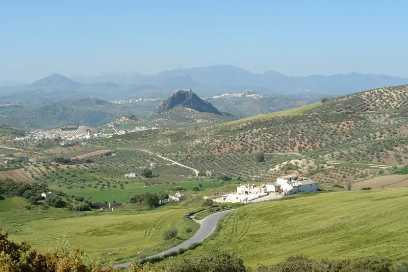
The white villages of Andalusia, or pueblos blancos, are hill towns of whitewashed houses in the mountains between Ronda, Seville and Jerez.
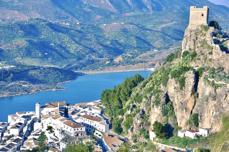
Zahara de la Sierra is a white village of about 1,300 people on a hillside inside the Sierra de Grazalema Natural Park, crowned by a 13th-century Nasrid castle and overlooking the turquoise Zahara-El Gastor reservoir.
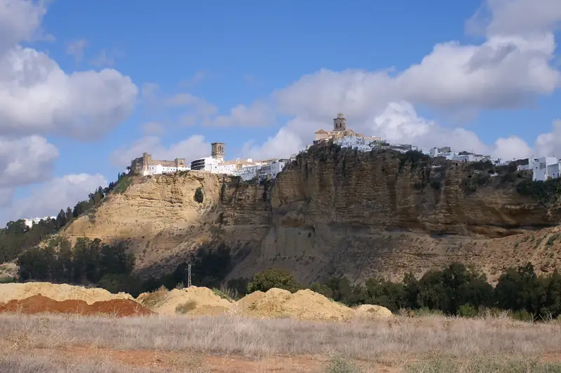
Arcos de la Frontera is a town of about 31,000 people whose old town sits on a sandstone ridge above vertical cliffs over the Río Guadalete.
The best time to visit Ronda, Setenil and the white villages of inland Andalusia is April to May or late September to October.