Ronda: Guided Walking Tour with English or Spanish Guide
1.5 hours
A low-cost group walk past the Puente Nuevo, the bullring and the Mondragón Palace, ending in Plaza de España.
from$28
Check availability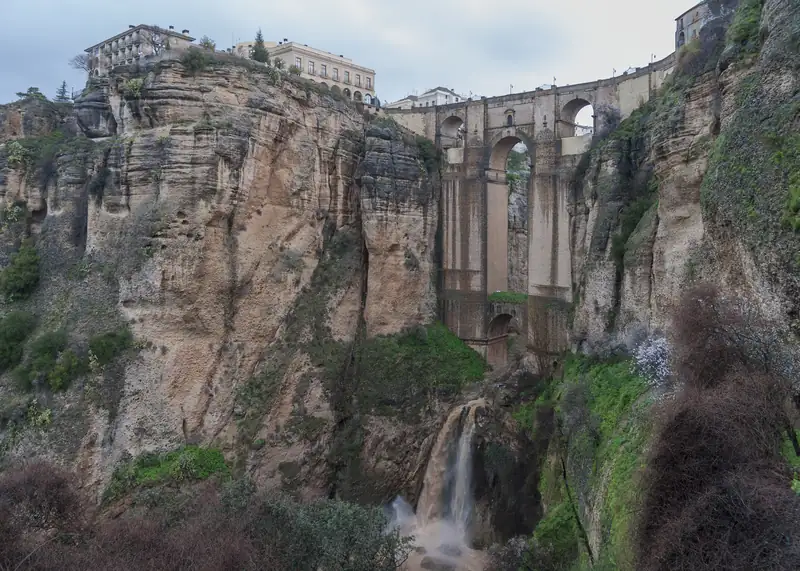
Ronda's Puente Nuevo crosses El Tajo, a gorge more than 100 metres deep, and joins the old and new halves of town. It was finished in 1793 after decades of work, and Ronda's tourist board puts its height at 98 metres. You can walk across it, visit the chamber inside, or walk down into the gorge.
The Ronda bridge most people mean is the Puente Nuevo, the “new bridge” over El Tajo gorge. The Río Guadalevín cut the gorge straight through the town, and the bridge joins the two halves: the old Moorish town, La Ciudad, on one side and the new town, El Mercadillo, on the other.
Crossing it is the easy part, since the street between the two halves of town runs over it. What takes planning is seeing it properly, which means getting off it.
The Puente Nuevo was finished in May 1793. Ronda’s tourist board says work started in 1751, which makes it a job of more than 40 years. Some histories say the project was approved in 1751 but building only began in 1759, which would make it 34. Andalusia’s tourist board also gives 1751 to 1793.
The architect who saw it through was José Martín de Aldehuela, from the village of Manzanera in Teruel. He also worked on Ronda’s bullring, which opened in 1785.
Ronda tried this once before. In 1735, under Felipe V, builders threw a single arch about 35 metres wide across the gorge in just eight months. Six years later it collapsed, and about 50 people died.
Ronda’s tourist board and Spain’s national tourism site both put the height at 98 metres. Spain.info adds that the bridge is up to 70 metres long.
You will see other figures. English Wikipedia gives a lower height for the structure, and the gorge is quoted at anything from “more than 100 metres” to 120 metres deep, depending on where you measure. We use 98 metres, the figure Ronda itself publishes.
Above the central arch is a chamber, entered from Plaza de España at the new-town end. It now holds the Puente Nuevo interpretation centre, a small exhibition on how the bridge was built and on the history, geology, plants and animals of the gorge.
It is one of the sites on Ronda’s municipal combined ticket (bono municipal), along with the Arab baths, the Palacio de Mondragón, the Casa del Gigante and the Museo Joaquín Peinado. We could not find current hours from the tourist board, so check with Ronda’s tourist office before you go.
The Puente Nuevo is the tallest of three. Andalusia’s tourist board describes the other two:
| Bridge | Date | Where |
|---|---|---|
| Puente Nuevo | Finished 1793 | Top of the gorge, between Plaza de España and the old town |
| Puente Viejo | 17th century | Further down, towards the Arab baths |
| Puente Romano | Muslim period, despite the name | Lowest, by the Arab baths |
A good walk links all three: cross the Puente Nuevo, wander the old town, drop down to the Arab baths, then climb back to the new town over the older bridges.
Mirador de Aldehuela. Right beside the bridge, in front of the old Convento de Santo Domingo. The easiest view to reach, and the busiest.
Plaza María Auxiliadora. A small square in the old town where both paths down into the gorge begin.
Jardines de Cuenca. Gardens on the north side of the gorge, between the Puente Nuevo and the Puente Viejo, named after Ronda’s twin town of Cuenca. They look across at the bridge from the side.
Paseo de Blas Infante and the Alameda del Tajo. The cliff-edge walk in the new town runs from the 19th-century Alameda del Tajo park, past the Parador’s terraces, to the bridge. Good for the gorge and the valley more than the bridge itself.
From below. The classic photo, with the full height of the arches, is taken from the bottom of the gorge. See the next section.
There are two ways down, one free and one ticketed.
From Plaza María Auxiliadora a path zigzags down the hillside below the old town to a viewpoint by an old Arab arch. It is steep and has no shade, so allow about an hour there and back, wear proper shoes and take water in summer. Partway down you reach the entrance to the paid path; the viewpoint just below its ticket kiosk is inside the paid section.
This ticketed path opened on 11 April 2024 and runs from Plaza María Auxiliadora to the base of the Puente Nuevo. In mid-September 2026 a second stretch opened: a 500-metre wooden walkway along the river, making the whole route about 700 metres. Numbers are limited per hour. When it opened in 2024, Andalusia’s tourist board said Ronda residents could enter free with their ID.
Book through the official site, desfiladerodeltajo.info, or Ronda’s tourist board. We do not quote the price because it has changed since the path opened.
A short walk from the bridge into the old town, the Casa del Rey Moro hides a much older route to the river. La Mina is a stairway cut inside the rock in the 14th century, during the Nasrid period, for military use, and it drops about 60 metres to the water. Chroniclers say a traitor revealed it to the Castilian army before Ronda fell in 1485. You visit it with the gardens above, laid out in 1912 by the French designer Jean Claude Nicolas Forestier.
For something more physical, a guided via ferrata climbs the gorge walls below the bridge with an instructor and all the gear. It is in the tours below this guide.
Half an hour covers crossing the bridge and the Mirador de Aldehuela. Add an hour for the free path down, or longer for the Camino del Desfiladero. If you want the story as well as the view, the group walk in our top pick passes the Puente Nuevo, the bullring and the Mondragón Palace in an hour and a half and ends in Plaza de España, at the bridge’s new-town end.
To see the bridge without the midday tour groups, stay a night: our guide to where to stay in Ronda compares the areas, and Ronda parking lists the car parks if you drive in. Most visitors combine the bridge with the rest of the town: our guide to things to do in Ronda has a one-day plan that starts here.
If you have a car, Setenil de las Bodegas is 19 km from Ronda, about 30 minutes’ drive. Where Ronda sits on top of its gorge, Setenil was built into the walls of another one, with houses and bars tucked under the rock along Calle Cuevas del Sol. It makes a good afternoon after a morning at the bridge. Our Setenil guide covers what to see.
Coming from the coast or Seville for the day? Read Málaga to Ronda or Seville to Ronda. Most day tours stop in both Ronda and Setenil; our tours page lists them.
1.5 hours
A low-cost group walk past the Puente Nuevo, the bullring and the Mondragón Palace, ending in Plaza de España.
from$28
Check availability2 hours
Clip on and climb the walls of the El Tajo gorge below the Puente Nuevo with an instructor, a small group and all the gear.
from$50
Check availability2 hours
Your own local guide for two hours through Ronda's park, old quarter and viewpoints, priced per group so it suits families.
from$135 per group (up to 10)
Check availability4 hours
A morning hop from Ronda bus station: coach to Setenil, a ride round the village on the tourist train and free time before the 1pm return.
from$19
Check availabilityPrices and ratings were taken from GetYourGuide and can change. Booking through these links supports this site at no extra cost to you.
Ronda's tourist board and Spain's national tourism site both give the Puente Nuevo a height of 98 metres, Other sources give lower figures for the bridge structure itself, and the gorge is over 100 metres deep in places. If you quote one number, use 98 metres and attribute it to Ronda's tourist board.
Ronda's tourist board says work began in 1751 and finished in May 1793, which makes more than 40 years. Some histories, including Spanish Wikipedia, say the project was approved in 1751 but building only started in 1759. Either way it replaced an earlier bridge of the 1730s that collapsed six years after it opened, killing about 50 people.
Yes. The Puente Nuevo carries the street between Ronda's new town and the old town, so you simply walk over it. For the best view of the bridge itself, step off it to the Mirador de Aldehuela beside it, or walk down the gorge path from Plaza María Auxiliadora in the old town.
Yes. The chamber above the central arch holds a small interpretation centre about how the bridge was built, its history and the gorge's geology, plants and animals. The entrance is on Plaza de España, at the new-town end of the bridge. It is one of the sites on Ronda's municipal combined ticket, so check current hours with the tourist office.
Yes, two ways. A free path drops from Plaza María Auxiliadora to the Arab arch viewpoint; it is steep and shadeless, about an hour there and back. The ticketed Camino del Desfiladero del Tajo goes to the base of the bridge and, since September 2026, along a wooden walkway by the river. Book that one online in advance.
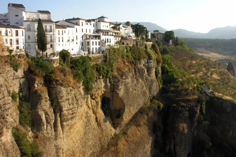
Ronda's main sight is the Puente Nuevo, the 18th-century bridge over the El Tajo gorge, which you can see from above, from inside and from below.
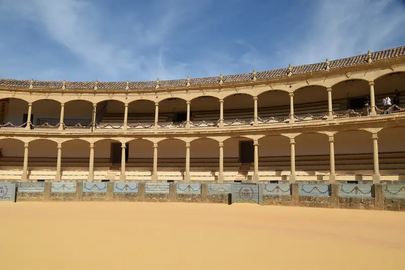
The easiest Ronda day trip from Málaga is a coach tour, and the most popular ones also stop in Setenil de las Bodegas.
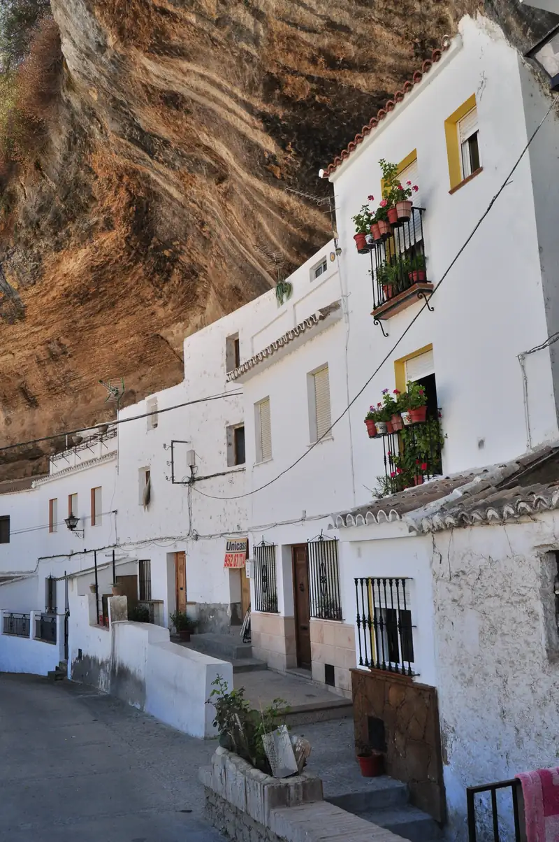
Seville to Ronda is about 125 km, roughly 1 hour 45 minutes by car or two hours on the Damas bus.